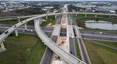
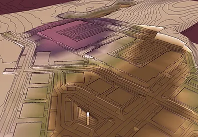
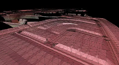
OUR SERVICES

3D SURFACE MODELING

3D SURFACE MODELING

We offer 3D surface modeling services for highway and sitework projects. Our models are compatible with automated machine grade control systems such as Trimble, Topcon, and other systems, providing you with the highest quality of accuracy.

AERIAL PHOTOGRAPHY

AERIAL PHOTOGRAPHY

From construction progress tracking to capturing specialized operations, our aerial photography services are tailored to meet your specific needs and deliver outstanding results.

EARTHWORKS ESTIMATING

EARTHWORKS ESTIMATING

Utilizing Agtek Earthwork software we offer a comprehensive earthwork takeoff service, generate cut and fill reports, provide 2D and 3D visualization, and even an overlay in Google Earth. We are the perfect solution for any of your earthwork needs.

HEAVY CIVIL ESTIMATING

HEAVY CIVIL ESTIMATING

We offer comprehensive estimating services using the heavy bid software for accurate takeoff and bid organizing. Our experienced team will work closely with you to ensure that your project is accurately estimated in a timely manner.